Map - Karaga District (Karaga)

Karaga District (Karaga)
Karaga District is one of the sixteen districts in Northern Region, Ghana. Originally it was formerly part of the then-larger Gushegu-Karaga District in 1988, which was created from the former East Dagomba District Council, until the western part of the district was split off to create Karaga District on 27 August 2004; thus the remaining part has been renamed as Gushegu District, which it was later elevated to municipal district assembly status on that same year to become Gushegu Municipal District. The district assembly is located in the northeast part of Northern Region and has Karaga as its capital town.

Karaga District's western neighbours are Savelugu Municipal District and Nanton District. To the north are West Mamprusi Municipal District and East Mamprusi Municipal District. To the south and east is the Gushegu Municipal District from which Karaga District was carved.

 
Map - Karaga District (Karaga)
Map
Google Earth - Map - Karaga District
Google Earth
Openstreetmap - Map - Karaga District
Openstreetmap
Map - Karaga District - Esri.WorldImagery
Esri.WorldImagery
Map - Karaga District - Esri.WorldStreetMap
Esri.WorldStreetMap
Map - Karaga District - OpenStreetMap.Mapnik
OpenStreetMap.Mapnik
Map - Karaga District - OpenStreetMap.HOT
OpenStreetMap.HOT
Map - Karaga District - CartoDB.Positron
CartoDB.Positron
Map - Karaga District - CartoDB.Voyager
CartoDB.Voyager
Map - Karaga District - OpenMapSurfer.Roads
OpenMapSurfer.Roads
Map - Karaga District - Esri.WorldTopoMap
Esri.WorldTopoMap
Map - Karaga District - Stamen.TonerLite
Stamen.TonerLite
Country - Ghana
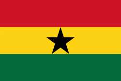
Flag of Ghana
Ghana, officially the Republic of Ghana, is a country in West Africa. It abuts the Gulf of Guinea and the Atlantic Ocean to the south, sharing borders with Ivory Coast in the west, Burkina Faso in the north, and Togo in the east. It covers an area of 238535 km2, spanning biomes that range from coastal savannas to tropical rainforests. With over 32 million inhabitants, Ghana is the second-most populous country in West Africa, after Nigeria.

The Bono state existed in the area that is modern day Ghana during the 11th century. Kingdoms and empires such as Kingdom of Dagbon in the north and the Ashanti Empire in the south emerged over the centuries. Beginning in the 15th century, the Portuguese Empire, followed by other European powers, contested the area for trading rights, until the British ultimately established control of the coast by the 19th century. Following over a century of colonial resistance, the current borders of the country took shape, encompassing 4 separate British colonial territories: Gold Coast, Ashanti, the Northern Territories, and British Togoland. These were unified as an independent dominion within the Commonwealth of Nations. On 6th March 1957, Ghana became the first country in Sub-Saharan Africa to achieve sovereignty. Ghana subsequently became influential in decolonisation efforts and the Pan-African movement.
Currency / Language  
ISO Currency Symbol Significant figures
GHS Ghanaian cedi ₵ 2
Neighbourhood - Country  
  •  Burkina Faso 
  •  Côte d'Ivoire 
  •  Togo